Discovering gis and arcgis pro – Welcome to the fascinating world of Geographic Information Systems (GIS) and ArcGIS Pro, where data comes to life, empowering you to make informed decisions and solve real-world problems. Join us as we delve into the depths of GIS, uncovering its significance, applications, and the powerful capabilities of ArcGIS Pro, the industry-leading GIS software platform.
From understanding the fundamentals of GIS to exploring its diverse applications, this comprehensive guide will equip you with the knowledge and skills to unlock the potential of GIS and ArcGIS Pro. Whether you’re a seasoned professional or just starting your journey, this guide is your roadmap to success in the exciting field of GIS.
Introduction
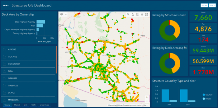
Geographic Information Systems (GIS) have become indispensable tools in modern society, enabling us to understand and manage the complex world around us. GIS integrates geographic data with other information to create interactive maps, 3D models, and other visualizations that provide valuable insights into spatial relationships and patterns.
GIS empowers us to analyze and solve real-world problems in various fields, including urban planning, environmental management, natural resource exploration, transportation, and public health. By leveraging GIS technology, we can make informed decisions, optimize resource allocation, and mitigate risks associated with spatial factors.
Capabilities and Applications of GIS
- Data Integration:GIS allows us to combine data from diverse sources, such as satellite imagery, census data, and social media feeds, to create a comprehensive understanding of a geographic area.
- Spatial Analysis:GIS provides powerful tools for analyzing spatial relationships, identifying patterns, and performing statistical operations on geographic data.
- Visualization:GIS enables the creation of visually appealing maps, charts, and 3D models that effectively communicate spatial information and insights.
- Decision Support:GIS supports decision-making by providing timely and accurate information about spatial factors that can influence outcomes.
- Collaboration:GIS facilitates collaboration among stakeholders by sharing geographic data and analysis results, enabling a shared understanding of spatial issues.
Discovering GIS
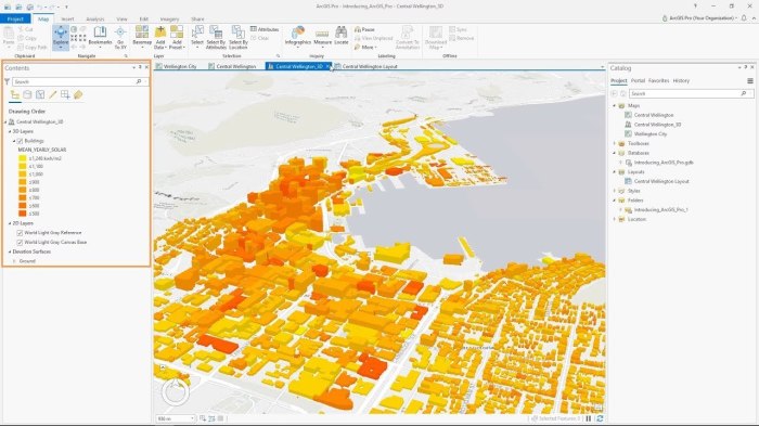
Defining GIS and Its Components
GIS, or Geographic Information Systems, is a framework for gathering, managing, and analyzing geographic data. It integrates hardware, software, and data for capturing, storing, checking, integrating, manipulating, analyzing, and displaying data related to positions on Earth’s surface.
GIS comprises several key components:
- Data: Spatial and non-spatial data, such as maps, aerial imagery, and attribute tables.
- Hardware: Computers, servers, and other devices used to store and process GIS data.
- Software: GIS applications like ArcGIS Pro, QGIS, and MapInfo Professional.
- People: GIS professionals who collect, manage, analyze, and present GIS data.
ArcGIS Pro

ArcGIS Pro is a professional GIS software platform developed by Esri. It offers a comprehensive suite of tools and features for creating, managing, analyzing, and visualizing geospatial data. ArcGIS Pro is widely used by professionals in various industries, including geography, planning, environmental science, and business intelligence.
Exploring GIS and ArcGIS Pro is an exciting journey that can unlock a world of spatial insights. While on this journey, we may encounter unexpected connections, like the Daughters of 1812 JROTC Award . This prestigious award recognizes outstanding young women in the JROTC program.
Returning to our exploration of GIS and ArcGIS Pro, these tools empower us to analyze and visualize spatial data, enabling us to make informed decisions and create a better understanding of the world around us.
Key Features and Functionalities
ArcGIS Pro provides a wide range of capabilities, including:
- Data management and processing
- Spatial analysis and modeling
- Mapping and visualization
- Geoprocessing automation
- Web GIS integration
li>3D GIS
Advantages of Using ArcGIS Pro
- Industry-leading GIS software with a wide range of capabilities
- User-friendly interface and intuitive workflows
- Extensive documentation and support resources
- Large community of users and developers
Disadvantages of Using ArcGIS Pro, Discovering gis and arcgis pro
- Can be expensive for some users
- Steep learning curve for new users
- May require additional hardware for optimal performance
Exploring GIS Applications
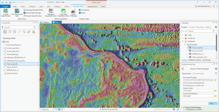
GIS has become an indispensable tool in various fields, revolutionizing the way we understand and manage our world. Its applications span a wide range of disciplines, from urban planning to environmental conservation.GIS empowers users to visualize, analyze, and interpret spatial data, enabling them to make informed decisions and solve complex problems.
It provides a comprehensive framework for understanding the relationships between different geographic features and their attributes, facilitating a deeper understanding of the world around us.
GIS in Urban Planning
GIS plays a crucial role in urban planning, assisting in the design and management of sustainable and livable cities. It enables planners to analyze land use patterns, transportation networks, and demographic data to make informed decisions about zoning, infrastructure development, and resource allocation.
GIS also supports the creation of 3D city models, providing a realistic visualization of urban environments for planning and decision-making.
GIS in Environmental Management
GIS is a powerful tool for environmental management, aiding in the conservation and protection of natural resources. It allows scientists and policymakers to map and analyze environmental data, such as land cover, water quality, and species distribution. GIS enables them to identify areas of ecological significance, monitor environmental changes, and develop strategies for sustainable land use and resource management.
GIS in Public Health
GIS has revolutionized the field of public health by providing a platform for analyzing and visualizing health data. It helps identify disease patterns, monitor outbreaks, and allocate resources for prevention and control. GIS also supports the development of health promotion programs and the evaluation of their effectiveness.
Benefits of Using GIS
GIS offers numerous benefits for various applications:
- Improved decision-making: GIS provides a comprehensive view of spatial data, enabling users to make informed decisions based on accurate and up-to-date information.
- Enhanced problem-solving: GIS facilitates the analysis of complex spatial relationships, allowing users to identify patterns, trends, and anomalies, leading to better problem-solving.
- Increased efficiency: GIS automates many tasks, such as data collection, analysis, and visualization, saving time and resources.
- Improved communication: GIS provides a common platform for sharing and visualizing spatial data, fostering collaboration and communication among stakeholders.
Challenges of Using GIS
Despite its numerous benefits, GIS also poses some challenges:
- Data availability and quality: Accessing and acquiring accurate and up-to-date spatial data can be challenging, especially for developing regions.
- Technical complexity: GIS software can be complex to use, requiring specialized knowledge and training to fully utilize its capabilities.
- Cost: Implementing and maintaining GIS systems can be expensive, particularly for large-scale projects.
- User adoption: Encouraging widespread adoption of GIS among decision-makers and stakeholders can be challenging due to resistance to change or lack of understanding.
Hands-on Practice
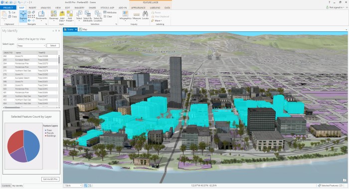
In this section, we will delve into the practical aspects of GIS using ArcGIS Pro. We will create a sample GIS project and explore various tools and features to perform basic GIS tasks.
Creating a GIS Project
To create a new GIS project in ArcGIS Pro, follow these steps:
- Launch ArcGIS Pro and click on the “New” button.
- Select “Blank Map” and click “OK.”
- A new map document will be created, and you can start adding data to it.
Adding Data to a GIS Project
There are several ways to add data to an ArcGIS Pro project. You can add data from local files, online sources, or databases. To add data from a local file, follow these steps:
- Click on the “Add Data” button on the ribbon.
- Browse to the location of the data file and select it.
- Click “Add.”
- The data will be added to the map and displayed in the Contents pane.
Creating and Editing GIS Data
Once you have added data to your project, you can start creating and editing GIS data. To create a new feature class, follow these steps:
- Click on the “Create” tab on the ribbon.
- Select “New Feature Class” from the drop-down menu.
- Enter a name and location for the new feature class.
- Select the geometry type for the feature class.
- Click “OK.”
- A new feature class will be created, and you can start adding features to it.
To edit GIS data, follow these steps:
- Select the feature class you want to edit.
- Click on the “Edit” tab on the ribbon.
- Select the edit tools you need to use.
- Make the necessary changes to the data.
- Click on the “Save” button to save the changes.
Performing Spatial Analysis
ArcGIS Pro offers a wide range of tools for performing spatial analysis. To perform spatial analysis, follow these steps:
- Select the data you want to analyze.
- Click on the “Analysis” tab on the ribbon.
- Select the analysis tool you want to use.
- Configure the parameters for the analysis tool.
- Click on the “Run” button to perform the analysis.
- The results of the analysis will be displayed in the map or in a table.
Generating Maps
ArcGIS Pro provides tools for generating high-quality maps. To create a map, follow these steps:
- Select the data you want to include in the map.
- Click on the “Insert” tab on the ribbon.
- Select “Map” from the drop-down menu.
- Configure the layout and design of the map.
- Click on the “Export” button to export the map as a PDF or other format.
Resources and Support: Discovering Gis And Arcgis Pro
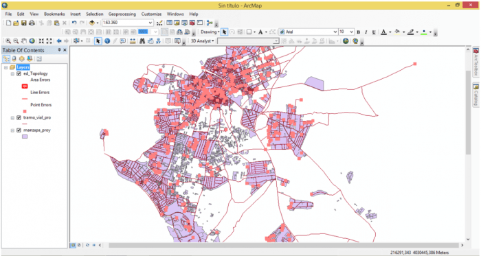
As you embark on your GIS journey, there are numerous resources and support systems available to enhance your learning and professional development.
One valuable resource is the Esri Support Center, which provides a comprehensive knowledge base, documentation, and technical support. Additionally, Esri’s online communities and forums offer a platform for users to connect, share knowledge, and engage with experts in the field.
Online Communities and Forums
- Esri Community: A global community of GIS users, developers, and enthusiasts where you can ask questions, share experiences, and connect with others.
- GIS Stack Exchange: A Q&A forum dedicated to GIS, where you can find answers to your technical questions and contribute your knowledge.
- LinkedIn GIS Groups: Join industry-specific groups on LinkedIn to connect with professionals in your field and stay updated on the latest GIS trends.
Training and Certification Programs
To advance your GIS skills and enhance your professional credibility, consider pursuing training and certification programs. Esri offers a range of courses, both online and in-person, to help you master ArcGIS Pro and other GIS technologies.
- ArcGIS Pro Fundamentals: This course provides a solid foundation in the core concepts and functionality of ArcGIS Pro.
- ArcGIS Desktop Associate Certification: This certification validates your proficiency in fundamental GIS concepts and ArcGIS Desktop software.
- ArcGIS Pro Professional Certification: This advanced certification demonstrates your expertise in ArcGIS Pro and its advanced capabilities.
Key Questions Answered
What is GIS?
GIS, or Geographic Information Systems, is a powerful technology that allows us to collect, manage, analyze, and visualize geographic data, enabling us to understand patterns, relationships, and trends in the world around us.
What is ArcGIS Pro?
ArcGIS Pro is a professional GIS software platform developed by Esri that provides a comprehensive suite of tools for geospatial data analysis, mapping, and visualization.
What are the benefits of using GIS?
GIS offers numerous benefits, including improved decision-making, enhanced problem-solving, increased efficiency, and better communication through the use of maps and visualizations.